Mullumbimby 1850
BV History Trail Maps – Ocean Shores/Billinudgel – Brunswick Heads – Mullumbimby/ Main Arm
As the cedar-getters and boat-builders made frequent trips up the river for materials, a camp site was established at the junction of the three arms of the Brunswick River. This grew to become a village and later the township of Mullumbimby. It was an excellent site because the river was tidal and could be easily navigated to that point, its central location gave access to all areas of the catchment area and it provided the best position for bullock teams to cross the river with their wagons loaded with timber.
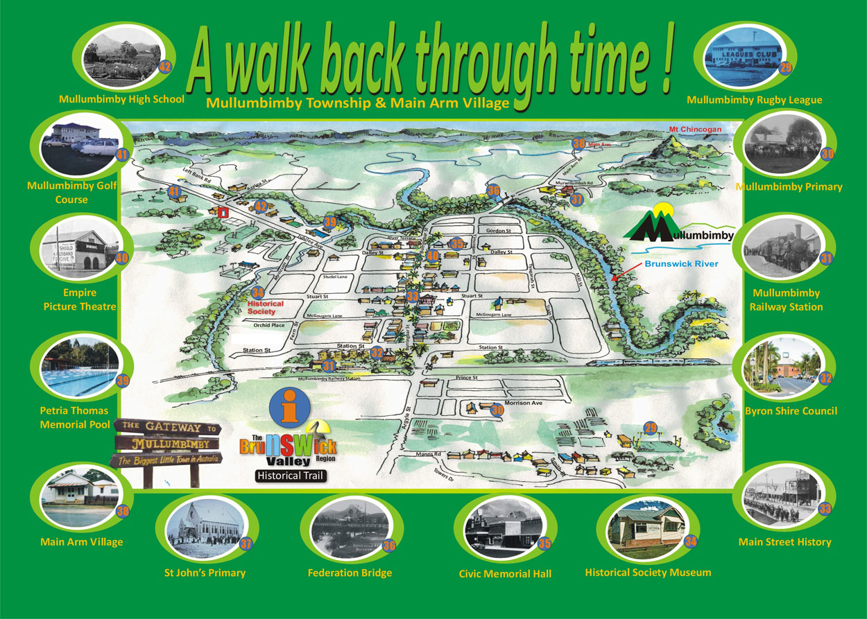
Proposed History Trail Locations:
Location 29 – Mullumbimby Rugby League
Location 30 – Mullumbimby Public School
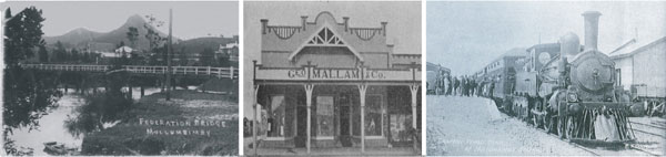
Location 31 – Mullumbimby Railway Station
Location 32 – Byron Shire Council Chambers
Location 33 – Main Street History
Location 34 – Historical Society Museum
Location 35 – Civic Memorial Hall
Location 36 – Federation Bridge
Location 37 – St John’s Primary School
Location 38 – Main Arm Village & Store
Location 39 – Petria Thomas Memorial Pool
Location 40 – Empire Picture Theatre & Cafe
Location 41 – Mullumbimby Golf Club
Location 42 – Mullumbimby High School
Weather Radar
Like Us on Facebook !

BV Business Directory

Online Community Booklet