Brunswick Heads 1828
BV History Trail Maps – Ocean Shores/Billinudgel – Brunswick Heads – Mullumbimby/ Main Arm
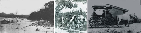
Captain Rous named the Brunswick River in 1828 but it was not until later that the first recorded settlement of Brunswick Heads took place. Steve King (a former convict) and the Boyd brothers set up camp and commenced logging for cedar along the banks of the Brunswick River in 1849.
By the early 1850′s Brunswick Heads had become an established sea port for transporting cedar to Sydney. Also, as the banks of the Brunswick River were lined with an abundance of timber species well suited to boat-building and repair, a large boat-building industry developed at Brunswick Heads.
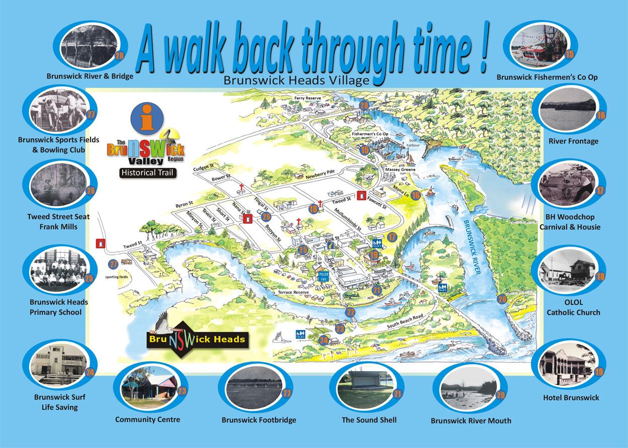
Proposed History Trail Locations:
Location 15 – Brunswick/Byron Fishermens Co Op
Location 16 – River Frontage
Location 17 – BH Woodchop Carnival & Housie Tent
Location 18 – Our Lady of Lourdes Catholic Church
Location 19 – Hotel Brunswick
Location 20 – Brunswick River Mouth & Wall
Location 21 – The Sound Shell
Location 22 – Brunswick Footbridge
Location 23 – Brunswick Heads Community Centre
Location 24 – Brunswick Surf Life Saving Club
Location 25 – Brunswick Heads Public School
location 26 – Tweed Street History Seat – Frank Mills
Location 27 – Brunswick Heads Sport Fields & Bowling Club
Location 28 – Brunswick River & Bridge
Weather Radar
Like Us on Facebook !

BV Business Directory

Online Community Booklet